• Trasy

    • Rower
    • Spacer
    • Wszystkie trasy
    • Zdjecia

    • Wszystkie zdjecia
    • Ciekawe miejsca
    • Krzyże
    • Kapliczki
    • Pozostałe
    • Zdjecia na mapie
    • Statystyki

    • Miejscowości
    • Roczne

26.05.2024 13:33

Ride
  • Dystans

    50.34 km

  • Średnia prędkość

    20.16 km/h

  • Maksymalna prędkość

    40.2 km/h

  • Czas ruchu

    02:29

  • Całkowity czas

    03:08

  • Najniższa wysokość

    235.8 m

  • Najwyższa wysokość

    315 m

  • Suma przewyższeń

    358 m

  • Kalorie

    1657

  • Kwadraty

    25

  • Zdjęcia
  • Trasa
  • Miejscowości
  • Segmenty
  • Inne

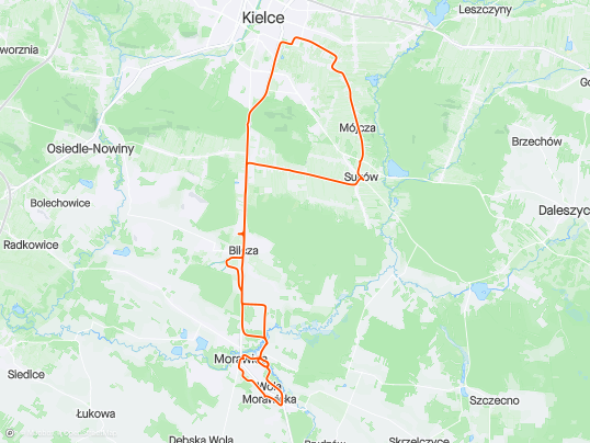
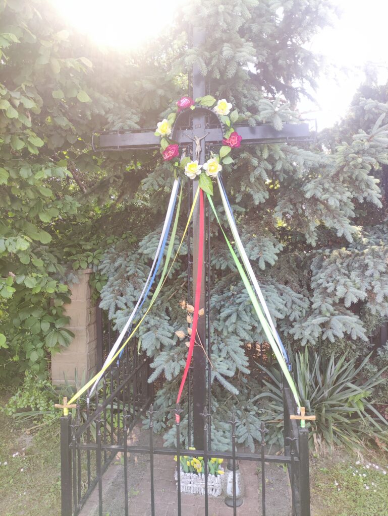
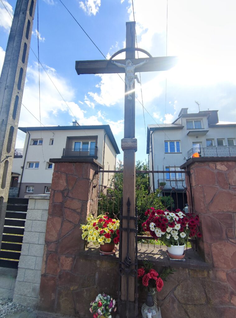
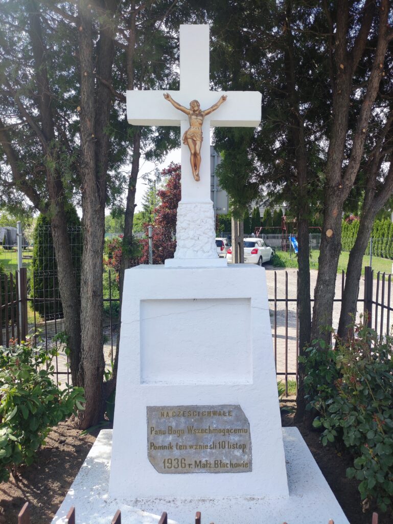
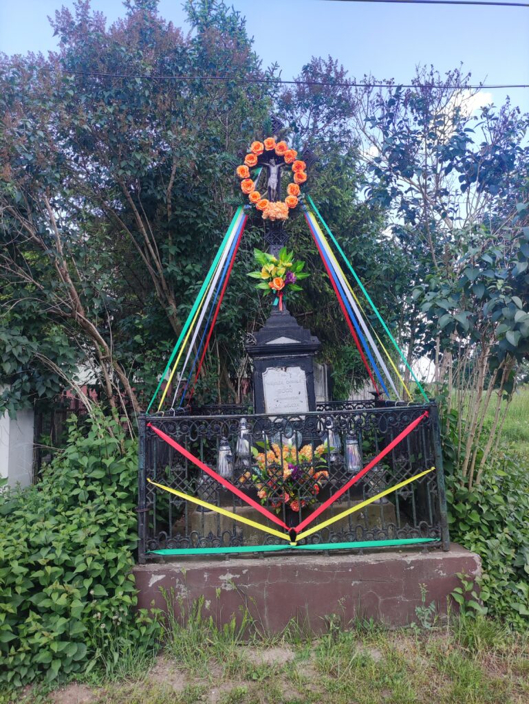
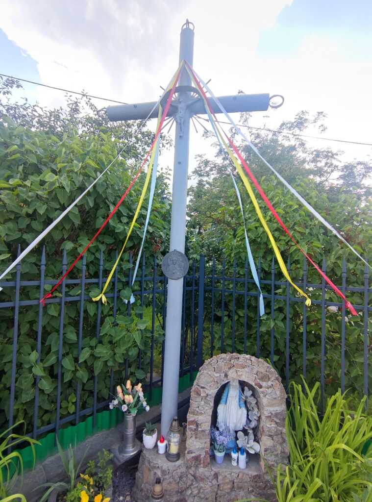
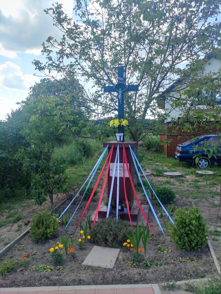
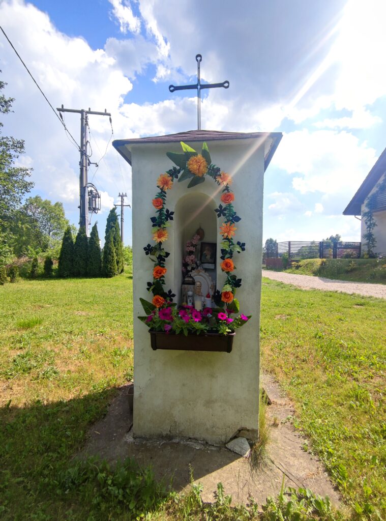
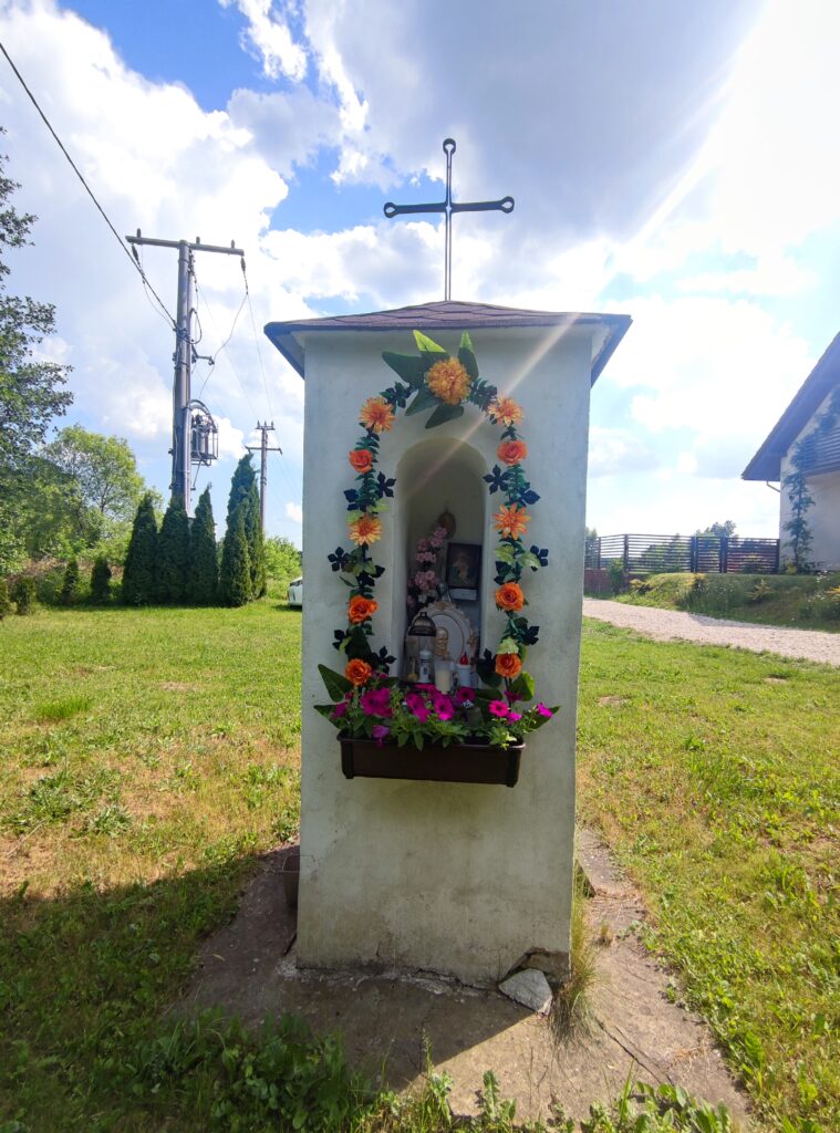
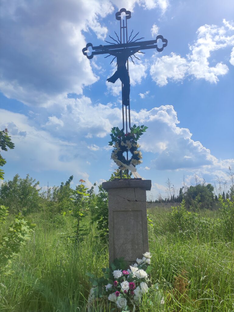
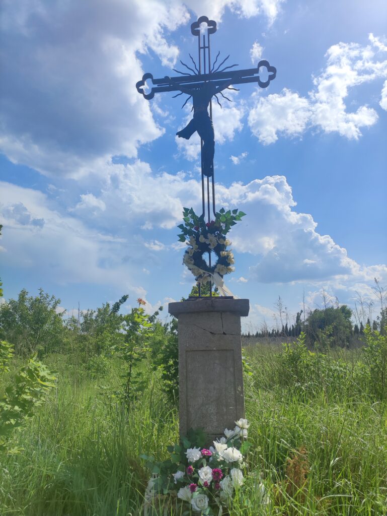
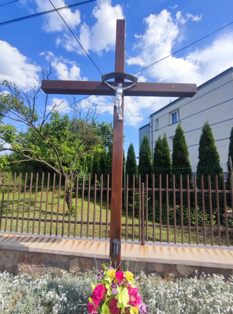
Zdjęcia na trasie

Księdza Piotra Ściegiennego
Kielce

Zagórska
Kielce

Prochownia
Kielce

Mójcza

Mójcza

Suków

Dymińska
Suków

Dymińska
Suków

Dymińska
Suków

Dymińska
Suków

Zagórska
Kielce

Trasa

PodziałDystans (km)Czas trwania (min)Różnica wysokości (m)Średnia prędkość (m/s)
11.042:78-7.86.58
20.968:45-43.77
31.005:5833.47
41.002:78-0.66.01
51.022:970.85.73
60.983:35-0.44.89
71.022:280.67.44
80.992:5210.66.77
90.983:9716.65.04
101.002:584.66.48
110.993:08-95.65
121.0221:8-34.65
131.022:77.86.28
141.002:53-3.66.57
151.012:5310.26.66
160.962:98185.5
171.052:6-12.66.74
180.973:05-1.65.31
190.991:92-7.88.65
201.022:42-7.67.99
210.964:083.44.74
221.013:8325.34
231.003:138.85.84
241.033:656.46.6
250.972:47-57.32
260.992:13-7.27.77
270.998:181.24.76
281.003:678.85.33
291.042:4214.47.17
300.963:07-6.45.2
311.024:98-3.44.48
321.004:226.44.86
331.013:0317.25.61
340.972:53-26.38
351.002:25-21.67.4
361.052:88-4.26.63
370.981:9-12.68.6
381.0021.48.32
390.992:5-1.66.6
401.022:7-7.66.46
410.968:410.44.28
421.023:7-44.6
431.032:87-22.87.39
440.972:4-0.27.01
451.002:88-2.65.81
461.003:621.64.72
470.983:370.24.92
481.003:172.45.26
491.003:320.25.05
501.024:628.44.1
510.312:021.63.8

Miejscowości

  • województwo świętokrzyskie
    • Kielce
      • Śródmieście
      • Zagórze
      • Wielkopole
      • Barwinek
      • Wietrznia
      • Dyminy-Wieś
    • powiat kielecki
      • gmina Morawica
        • Wola Morawicka
        • Brzeziny
        • Bieleckie Młyny
        • Piaseczna Górka
        • Bilcza
        • Dyminy
        • Łabędziów
        • Morawica
      • gmina Daleszyce
        • Suków
        • Mójcza

Strava segmenty

NazwaCzas trwania (s)Czas w ruchu (s)Odległość (m)Średnie nachylenie (%)Maksymalne nachylenie (%)Wysokość maks.Wysokość min.
Zalew Morawica1681681016.8-0.34.4230.5226.1
Piaseczna Górka [ul. Żurawia]1141147791.47.2249.1235.3
Dyminy - Suków7096604213.6-0.86.3287246
Sukowska GreenVelo2312311343.8-1.41.5287267.7
Dyminy, Kielecka (Dymińska - Sukowska)118118597.2-0.42.3266.2262.1
Do sukowa 3302811939-0.63.8262.4247.6
Suków (Szkoła - Obwodnica)7272442.31.64.4256.7249.7
Mójcz Suków-Prosta7726844155.10.34.6272.1249.8
Mójcza (obwodnica Sukowa - Skalna)4053192042.50.63.8272.6258.4
Mójcza - Kielce13929805909.40.35.8273.4256.2
Mójcza (Skalna - Prosta)2192171489.7-0.74.1271.4256.6
Prosta (Mójcza - Zagórska)9292483.92.56.3272.4260.5
Zagórska zjazd od Prostej 133110485-21272.8262
Zagórska (zakręt - Napękowska)190151782.713.3271.2263.3
Zagórska (Napękowska - Głogowa pętla)4141308.41.13.7273.7270.3
Zagórska (Głogowa - Szczecińska)48483323.15.4284.8274.6
ścieżka Tarnowska od Premy do Castoramy166166659.12.54.4286.1269.4
Ks.P.Ściegiennego6536534537.2-13.9302.9251
Lecznica - Rolmet2252251409.4-1.73.6307279.4
Zalew Morawica1821821016.8-0.34.4230.5226.1
Array
(
    [0] => Array
        (
            [id] => 3229822675807076000
            [resource_state] => 2
            [name] => Zalew Morawica
            [activity] => Array
                (
                    [id] => 11502722571
                    [visibility] => everyone
                    [resource_state] => 1
                )

            [athlete] => Array
                (
                    [id] => 12652371
                    [resource_state] => 1
                )

            [elapsed_time] => 168
            [moving_time] => 168
            [start_date] => 2024-05-26T11:52:08.000Z
            [start_date_local] => 2024-05-26T13:52:08.000Z
            [distance] => 1016.8
            [start_index] => 197
            [end_index] => 232
            [device_watts] => 
            [segment] => Array
                (
                    [id] => 20911278
                    [resource_state] => 2
                    [name] => Zalew Morawica
                    [activity_type] => Ride
                    [distance] => 1016.8
                    [average_grade] => -0.3
                    [maximum_grade] => 4.4
                    [elevation_high] => 230.5
                    [elevation_low] => 226.1
                    [start_latlng] => Array
                        (
                            [0] => 50.747952
                            [1] => 20.630124
                        )

                    [end_latlng] => Array
                        (
                            [0] => 50.746902
                            [1] => 20.628116
                        )

                    [elevation_profile] => 
                    [elevation_profiles] => 
                    [climb_category] => 0
                    [city] => Morawica
                    [state] => świętokrzyskie
                    [country] => Poland
                    [private] => 
                    [hazardous] => 
                    [starred] => 1
                )

            [pr_rank] => 
            [achievements] => Array
                (
                    [0] => Array
                        (
                            [type_id] => 7
                            [type] => segment_effort_count_leader
                            [rank] => 1
                            [effort_count] => 42
                        )

                )

            [visibility] => everyone
            [kom_rank] => 
            [hidden] => 
        )

    [1] => Array
        (
            [id] => 3229822675803776500
            [resource_state] => 2
            [name] => Piaseczna Górka [ul. Żurawia]
            [activity] => Array
                (
                    [id] => 11502722571
                    [visibility] => everyone
                    [resource_state] => 1
                )

            [athlete] => Array
                (
                    [id] => 12652371
                    [resource_state] => 1
                )

            [elapsed_time] => 114
            [moving_time] => 114
            [start_date] => 2024-05-26T12:02:41.000Z
            [start_date_local] => 2024-05-26T14:02:41.000Z
            [distance] => 779
            [start_index] => 310
            [end_index] => 324
            [device_watts] => 
            [segment] => Array
                (
                    [id] => 14785144
                    [resource_state] => 2
                    [name] => Piaseczna Górka [ul. Żurawia]
                    [activity_type] => Ride
                    [distance] => 779
                    [average_grade] => 1.4
                    [maximum_grade] => 7.2
                    [elevation_high] => 249.1
                    [elevation_low] => 235.3
                    [start_latlng] => Array
                        (
                            [0] => 50.767702
                            [1] => 20.632692
                        )

                    [end_latlng] => Array
                        (
                            [0] => 50.767942
                            [1] => 20.621627
                        )

                    [elevation_profile] => 
                    [elevation_profiles] => 
                    [climb_category] => 0
                    [city] => 
                    [state] => świętokrzyskie
                    [country] => Poland
                    [private] => 
                    [hazardous] => 
                    [starred] => 
                )

            [pr_rank] => 
            [achievements] => Array
                (
                )

            [visibility] => everyone
            [kom_rank] => 
            [hidden] => 
        )

    [2] => Array
        (
            [id] => 3229822675799588400
            [resource_state] => 2
            [name] => Dyminy - Suków
            [activity] => Array
                (
                    [id] => 11502722571
                    [visibility] => everyone
                    [resource_state] => 1
                )

            [athlete] => Array
                (
                    [id] => 12652371
                    [resource_state] => 1
                )

            [elapsed_time] => 709
            [moving_time] => 660
            [start_date] => 2024-05-26T12:45:51.000Z
            [start_date_local] => 2024-05-26T14:45:51.000Z
            [distance] => 4213.6
            [start_index] => 530
            [end_index] => 631
            [device_watts] => 
            [segment] => Array
                (
                    [id] => 15916634
                    [resource_state] => 2
                    [name] => Dyminy - Suków
                    [activity_type] => Ride
                    [distance] => 4213.6
                    [average_grade] => -0.8
                    [maximum_grade] => 6.3
                    [elevation_high] => 287
                    [elevation_low] => 246
                    [start_latlng] => Array
                        (
                            [0] => 50.81919
                            [1] => 20.625515
                        )

                    [end_latlng] => Array
                        (
                            [0] => 50.811387
                            [1] => 20.683711
                        )

                    [elevation_profile] => 
                    [elevation_profiles] => 
                    [climb_category] => 0
                    [city] => Kielce
                    [state] => świętokrzyskie
                    [country] => Poland
                    [private] => 
                    [hazardous] => 
                    [starred] => 
                )

            [pr_rank] => 
            [achievements] => Array
                (
                )

            [visibility] => everyone
            [kom_rank] => 
            [hidden] => 
        )

    [3] => Array
        (
            [id] => 3229822675806426600
            [resource_state] => 2
            [name] => Sukowska GreenVelo
            [activity] => Array
                (
                    [id] => 11502722571
                    [visibility] => everyone
                    [resource_state] => 1
                )

            [athlete] => Array
                (
                    [id] => 12652371
                    [resource_state] => 1
                )

            [elapsed_time] => 231
            [moving_time] => 231
            [start_date] => 2024-05-26T12:47:15.000Z
            [start_date_local] => 2024-05-26T14:47:15.000Z
            [distance] => 1343.8
            [start_index] => 542
            [end_index] => 579
            [device_watts] => 
            [segment] => Array
                (
                    [id] => 24797402
                    [resource_state] => 2
                    [name] => Sukowska GreenVelo
                    [activity_type] => Ride
                    [distance] => 1343.8
                    [average_grade] => -1.4
                    [maximum_grade] => 1.5
                    [elevation_high] => 287
                    [elevation_low] => 267.7
                    [start_latlng] => Array
                        (
                            [0] => 50.818471
                            [1] => 20.631559
                        )

                    [end_latlng] => Array
                        (
                            [0] => 50.816114
                            [1] => 20.650261
                        )

                    [elevation_profile] => 
                    [elevation_profiles] => 
                    [climb_category] => 0
                    [city] => Kielce
                    [state] => Świętokrzyskie
                    [country] => Poland
                    [private] => 
                    [hazardous] => 
                    [starred] => 
                )

            [pr_rank] => 
            [achievements] => Array
                (
                )

            [visibility] => everyone
            [kom_rank] => 
            [hidden] => 
        )

    [4] => Array
        (
            [id] => 3229822675803011600
            [resource_state] => 2
            [name] => Dyminy, Kielecka (Dymińska - Sukowska)
            [activity] => Array
                (
                    [id] => 11502722571
                    [visibility] => everyone
                    [resource_state] => 1
                )

            [athlete] => Array
                (
                    [id] => 12652371
                    [resource_state] => 1
                )

            [elapsed_time] => 118
            [moving_time] => 118
            [start_date] => 2024-05-26T12:50:04.000Z
            [start_date_local] => 2024-05-26T14:50:04.000Z
            [distance] => 597.2
            [start_index] => 569
            [end_index] => 586
            [device_watts] => 
            [segment] => Array
                (
                    [id] => 17619888
                    [resource_state] => 2
                    [name] => Dyminy, Kielecka (Dymińska - Sukowska)
                    [activity_type] => Ride
                    [distance] => 597.2
                    [average_grade] => -0.4
                    [maximum_grade] => 2.3
                    [elevation_high] => 266.2
                    [elevation_low] => 262.1
                    [start_latlng] => Array
                        (
                            [0] => 50.816581
                            [1] => 20.646686
                        )

                    [end_latlng] => Array
                        (
                            [0] => 50.815574
                            [1] => 20.655014
                        )

                    [elevation_profile] => 
                    [elevation_profiles] => 
                    [climb_category] => 0
                    [city] => 
                    [state] => świętokrzyskie
                    [country] => Poland
                    [private] => 
                    [hazardous] => 
                    [starred] => 
                )

            [pr_rank] => 
            [achievements] => Array
                (
                )

            [visibility] => everyone
            [kom_rank] => 
            [hidden] => 
        )

    [5] => Array
        (
            [id] => 3229822675800249000
            [resource_state] => 2
            [name] => Do sukowa 
            [activity] => Array
                (
                    [id] => 11502722571
                    [visibility] => everyone
                    [resource_state] => 1
                )

            [athlete] => Array
                (
                    [id] => 12652371
                    [resource_state] => 1
                )

            [elapsed_time] => 330
            [moving_time] => 281
            [start_date] => 2024-05-26T12:52:18.000Z
            [start_date_local] => 2024-05-26T14:52:18.000Z
            [distance] => 1939
            [start_index] => 588
            [end_index] => 632
            [device_watts] => 
            [segment] => Array
                (
                    [id] => 14609877
                    [resource_state] => 2
                    [name] => Do sukowa 
                    [activity_type] => Ride
                    [distance] => 1939
                    [average_grade] => -0.6
                    [maximum_grade] => 3.8
                    [elevation_high] => 262.4
                    [elevation_low] => 247.6
                    [start_latlng] => Array
                        (
                            [0] => 50.815239
                            [1] => 20.657138
                        )

                    [end_latlng] => Array
                        (
                            [0] => 50.811416
                            [1] => 20.683928
                        )

                    [elevation_profile] => 
                    [elevation_profiles] => 
                    [climb_category] => 0
                    [city] => Suków
                    [state] => świętokrzyskie
                    [country] => Poland
                    [private] => 
                    [hazardous] => 
                    [starred] => 
                )

            [pr_rank] => 
            [achievements] => Array
                (
                )

            [visibility] => everyone
            [kom_rank] => 
            [hidden] => 
        )

    [6] => Array
        (
            [id] => 3229822675800739300
            [resource_state] => 2
            [name] => Suków (Szkoła - Obwodnica)
            [activity] => Array
                (
                    [id] => 11502722571
                    [visibility] => everyone
                    [resource_state] => 1
                )

            [athlete] => Array
                (
                    [id] => 12652371
                    [resource_state] => 1
                )

            [elapsed_time] => 72
            [moving_time] => 72
            [start_date] => 2024-05-26T13:02:24.000Z
            [start_date_local] => 2024-05-26T15:02:24.000Z
            [distance] => 442.3
            [start_index] => 672
            [end_index] => 681
            [device_watts] => 
            [segment] => Array
                (
                    [id] => 21254510
                    [resource_state] => 2
                    [name] => Suków (Szkoła - Obwodnica)
                    [activity_type] => Ride
                    [distance] => 442.3
                    [average_grade] => 1.6
                    [maximum_grade] => 4.4
                    [elevation_high] => 256.7
                    [elevation_low] => 249.7
                    [start_latlng] => Array
                        (
                            [0] => 50.815677
                            [1] => 20.685235
                        )

                    [end_latlng] => Array
                        (
                            [0] => 50.819447
                            [1] => 20.687168
                        )

                    [elevation_profile] => 
                    [elevation_profiles] => 
                    [climb_category] => 0
                    [city] => Suków
                    [state] => świętokrzyskie
                    [country] => Poland
                    [private] => 
                    [hazardous] => 
                    [starred] => 
                )

            [pr_rank] => 
            [achievements] => Array
                (
                )

            [visibility] => everyone
            [kom_rank] => 
            [hidden] => 
        )

    [7] => Array
        (
            [id] => 3229822675800399400
            [resource_state] => 2
            [name] => Mójcz Suków-Prosta
            [activity] => Array
                (
                    [id] => 11502722571
                    [visibility] => everyone
                    [resource_state] => 1
                )

            [athlete] => Array
                (
                    [id] => 12652371
                    [resource_state] => 1
                )

            [elapsed_time] => 772
            [moving_time] => 684
            [start_date] => 2024-05-26T13:02:32.000Z
            [start_date_local] => 2024-05-26T15:02:32.000Z
            [distance] => 4155.1
            [start_index] => 673
            [end_index] => 776
            [device_watts] => 
            [segment] => Array
                (
                    [id] => 14483976
                    [resource_state] => 2
                    [name] => Mójcz Suków-Prosta
                    [activity_type] => Ride
                    [distance] => 4155.1
                    [average_grade] => 0.3
                    [maximum_grade] => 4.6
                    [elevation_high] => 272.1
                    [elevation_low] => 249.8
                    [start_latlng] => Array
                        (
                            [0] => 50.816044
                            [1] => 20.685489
                        )

                    [end_latlng] => Array
                        (
                            [0] => 50.851906
                            [1] => 20.677092
                        )

                    [elevation_profile] => 
                    [elevation_profiles] => 
                    [climb_category] => 0
                    [city] => Suków
                    [state] => świętokrzyskie
                    [country] => Poland
                    [private] => 
                    [hazardous] => 
                    [starred] => 
                )

            [pr_rank] => 
            [achievements] => Array
                (
                )

            [visibility] => everyone
            [kom_rank] => 
            [hidden] => 
        )

    [8] => Array
        (
            [id] => 3229822675800184300
            [resource_state] => 2
            [name] => Mójcza (obwodnica Sukowa - Skalna)
            [activity] => Array
                (
                    [id] => 11502722571
                    [visibility] => everyone
                    [resource_state] => 1
                )

            [athlete] => Array
                (
                    [id] => 12652371
                    [resource_state] => 1
                )

            [elapsed_time] => 405
            [moving_time] => 319
            [start_date] => 2024-05-26T13:04:52.000Z
            [start_date_local] => 2024-05-26T15:04:52.000Z
            [distance] => 2042.5
            [start_index] => 699
            [end_index] => 747
            [device_watts] => 
            [segment] => Array
                (
                    [id] => 21254545
                    [resource_state] => 2
                    [name] => Mójcza (obwodnica Sukowa - Skalna)
                    [activity_type] => Ride
                    [distance] => 2042.5
                    [average_grade] => 0.6
                    [maximum_grade] => 3.8
                    [elevation_high] => 272.6
                    [elevation_low] => 258.4
                    [start_latlng] => Array
                        (
                            [0] => 50.820729
                            [1] => 20.687829
                        )

                    [end_latlng] => Array
                        (
                            [0] => 50.838566
                            [1] => 20.683168
                        )

                    [elevation_profile] => 
                    [elevation_profiles] => 
                    [climb_category] => 0
                    [city] => Suków
                    [state] => świętokrzyskie
                    [country] => Poland
                    [private] => 
                    [hazardous] => 
                    [starred] => 
                )

            [pr_rank] => 
            [achievements] => Array
                (
                )

            [visibility] => everyone
            [kom_rank] => 
            [hidden] => 
        )

    [9] => Array
        (
            [id] => 3229822675802380000
            [resource_state] => 2
            [name] => Mójcza - Kielce
            [activity] => Array
                (
                    [id] => 11502722571
                    [visibility] => everyone
                    [resource_state] => 1
                )

            [athlete] => Array
                (
                    [id] => 12652371
                    [resource_state] => 1
                )

            [elapsed_time] => 1392
            [moving_time] => 980
            [start_date] => 2024-05-26T13:04:52.000Z
            [start_date_local] => 2024-05-26T15:04:52.000Z
            [distance] => 5909.4
            [start_index] => 699
            [end_index] => 846
            [device_watts] => 
            [segment] => Array
                (
                    [id] => 23361433
                    [resource_state] => 2
                    [name] => Mójcza - Kielce
                    [activity_type] => Ride
                    [distance] => 5909.4
                    [average_grade] => 0.3
                    [maximum_grade] => 5.8
                    [elevation_high] => 273.4
                    [elevation_low] => 256.2
                    [start_latlng] => Array
                        (
                            [0] => 50.820722
                            [1] => 20.687843
                        )

                    [end_latlng] => Array
                        (
                            [0] => 50.863509
                            [1] => 20.658727
                        )

                    [elevation_profile] => 
                    [elevation_profiles] => 
                    [climb_category] => 0
                    [city] => Suków
                    [state] => świętokrzyskie
                    [country] => Poland
                    [private] => 
                    [hazardous] => 
                    [starred] => 
                )

            [pr_rank] => 
            [achievements] => Array
                (
                )

            [visibility] => everyone
            [kom_rank] => 
            [hidden] => 
        )

    [10] => Array
        (
            [id] => 3229822675803034000
            [resource_state] => 2
            [name] => Mójcza (Skalna - Prosta)
            [activity] => Array
                (
                    [id] => 11502722571
                    [visibility] => everyone
                    [resource_state] => 1
                )

            [athlete] => Array
                (
                    [id] => 12652371
                    [resource_state] => 1
                )

            [elapsed_time] => 219
            [moving_time] => 217
            [start_date] => 2024-05-26T13:11:45.000Z
            [start_date_local] => 2024-05-26T15:11:45.000Z
            [distance] => 1489.7
            [start_index] => 748
            [end_index] => 776
            [device_watts] => 
            [segment] => Array
                (
                    [id] => 21263477
                    [resource_state] => 2
                    [name] => Mójcza (Skalna - Prosta)
                    [activity_type] => Ride
                    [distance] => 1489.7
                    [average_grade] => -0.7
                    [maximum_grade] => 4.1
                    [elevation_high] => 271.4
                    [elevation_low] => 256.6
                    [start_latlng] => Array
                        (
                            [0] => 50.839437
                            [1] => 20.682845
                        )

                    [end_latlng] => Array
                        (
                            [0] => 50.852038
                            [1] => 20.676949
                        )

                    [elevation_profile] => 
                    [elevation_profiles] => 
                    [climb_category] => 0
                    [city] => Mójcza
                    [state] => świętokrzyskie
                    [country] => Poland
                    [private] => 
                    [hazardous] => 
                    [starred] => 
                )

            [pr_rank] => 
            [achievements] => Array
                (
                )

            [visibility] => everyone
            [kom_rank] => 
            [hidden] => 
        )

    [11] => Array
        (
            [id] => 3229822675801881000
            [resource_state] => 2
            [name] => Prosta (Mójcza - Zagórska)
            [activity] => Array
                (
                    [id] => 11502722571
                    [visibility] => everyone
                    [resource_state] => 1
                )

            [athlete] => Array
                (
                    [id] => 12652371
                    [resource_state] => 1
                )

            [elapsed_time] => 92
            [moving_time] => 92
            [start_date] => 2024-05-26T13:19:59.000Z
            [start_date_local] => 2024-05-26T15:19:59.000Z
            [distance] => 483.9
            [start_index] => 781
            [end_index] => 793
            [device_watts] => 
            [segment] => Array
                (
                    [id] => 21263578
                    [resource_state] => 2
                    [name] => Prosta (Mójcza - Zagórska)
                    [activity_type] => Ride
                    [distance] => 483.9
                    [average_grade] => 2.5
                    [maximum_grade] => 6.3
                    [elevation_high] => 272.4
                    [elevation_low] => 260.5
                    [start_latlng] => Array
                        (
                            [0] => 50.852453
                            [1] => 20.676541
                        )

                    [end_latlng] => Array
                        (
                            [0] => 50.854103
                            [1] => 20.670498
                        )

                    [elevation_profile] => 
                    [elevation_profiles] => 
                    [climb_category] => 0
                    [city] => Kielce
                    [state] => świętokrzyskie
                    [country] => Poland
                    [private] => 
                    [hazardous] => 
                    [starred] => 
                )

            [pr_rank] => 
            [achievements] => Array
                (
                )

            [visibility] => everyone
            [kom_rank] => 
            [hidden] => 
        )

    [12] => Array
        (
            [id] => 3229822675799412000
            [resource_state] => 2
            [name] => Zagórska zjazd od Prostej 
            [activity] => Array
                (
                    [id] => 11502722571
                    [visibility] => everyone
                    [resource_state] => 1
                )

            [athlete] => Array
                (
                    [id] => 12652371
                    [resource_state] => 1
                )

            [elapsed_time] => 133
            [moving_time] => 110
            [start_date] => 2024-05-26T13:21:38.000Z
            [start_date_local] => 2024-05-26T15:21:38.000Z
            [distance] => 485
            [start_index] => 796
            [end_index] => 813
            [device_watts] => 
            [segment] => Array
                (
                    [id] => 15215745
                    [resource_state] => 2
                    [name] => Zagórska zjazd od Prostej 
                    [activity_type] => Ride
                    [distance] => 485
                    [average_grade] => -2
                    [maximum_grade] => 1
                    [elevation_high] => 272.8
                    [elevation_low] => 262
                    [start_latlng] => Array
                        (
                            [0] => 50.85441
                            [1] => 20.670172
                        )

                    [end_latlng] => Array
                        (
                            [0] => 50.858081
                            [1] => 20.673387
                        )

                    [elevation_profile] => 
                    [elevation_profiles] => 
                    [climb_category] => 0
                    [city] => Kielce
                    [state] => świętokrzyskie
                    [country] => Poland
                    [private] => 
                    [hazardous] => 
                    [starred] => 
                )

            [pr_rank] => 
            [achievements] => Array
                (
                )

            [visibility] => everyone
            [kom_rank] => 
            [hidden] => 
        )

    [13] => Array
        (
            [id] => 3229822675801608700
            [resource_state] => 2
            [name] => Zagórska (zakręt - Napękowska)
            [activity] => Array
                (
                    [id] => 11502722571
                    [visibility] => everyone
                    [resource_state] => 1
                )

            [athlete] => Array
                (
                    [id] => 12652371
                    [resource_state] => 1
                )

            [elapsed_time] => 190
            [moving_time] => 151
            [start_date] => 2024-05-26T13:23:57.000Z
            [start_date_local] => 2024-05-26T15:23:57.000Z
            [distance] => 782.7
            [start_index] => 814
            [end_index] => 839
            [device_watts] => 
            [segment] => Array
                (
                    [id] => 21263588
                    [resource_state] => 2
                    [name] => Zagórska (zakręt - Napękowska)
                    [activity_type] => Ride
                    [distance] => 782.7
                    [average_grade] => 1
                    [maximum_grade] => 3.3
                    [elevation_high] => 271.2
                    [elevation_low] => 263.3
                    [start_latlng] => Array
                        (
                            [0] => 50.8583
                            [1] => 20.673258
                        )

                    [end_latlng] => Array
                        (
                            [0] => 50.861786
                            [1] => 20.663602
                        )

                    [elevation_profile] => 
                    [elevation_profiles] => 
                    [climb_category] => 0
                    [city] => Kielce
                    [state] => świętokrzyskie
                    [country] => Poland
                    [private] => 
                    [hazardous] => 
                    [starred] => 
                )

            [pr_rank] => 
            [achievements] => Array
                (
                )

            [visibility] => everyone
            [kom_rank] => 
            [hidden] => 
        )

    [14] => Array
        (
            [id] => 3229822675801669000
            [resource_state] => 2
            [name] => Zagórska (Napękowska - Głogowa pętla)
            [activity] => Array
                (
                    [id] => 11502722571
                    [visibility] => everyone
                    [resource_state] => 1
                )

            [athlete] => Array
                (
                    [id] => 12652371
                    [resource_state] => 1
                )

            [elapsed_time] => 41
            [moving_time] => 41
            [start_date] => 2024-05-26T13:27:23.000Z
            [start_date_local] => 2024-05-26T15:27:23.000Z
            [distance] => 308.4
            [start_index] => 841
            [end_index] => 846
            [device_watts] => 
            [segment] => Array
                (
                    [id] => 21263621
                    [resource_state] => 2
                    [name] => Zagórska (Napękowska - Głogowa pętla)
                    [activity_type] => Ride
                    [distance] => 308.4
                    [average_grade] => 1.1
                    [maximum_grade] => 3.7
                    [elevation_high] => 273.7
                    [elevation_low] => 270.3
                    [start_latlng] => Array
                        (
                            [0] => 50.862147
                            [1] => 20.662559
                        )

                    [end_latlng] => Array
                        (
                            [0] => 50.863537
                            [1] => 20.658796
                        )

                    [elevation_profile] => 
                    [elevation_profiles] => 
                    [climb_category] => 0
                    [city] => Kielce
                    [state] => świętokrzyskie
                    [country] => Poland
                    [private] => 
                    [hazardous] => 
                    [starred] => 
                )

            [pr_rank] => 
            [achievements] => Array
                (
                )

            [visibility] => everyone
            [kom_rank] => 
            [hidden] => 
        )

    [15] => Array
        (
            [id] => 3229822675800139300
            [resource_state] => 2
            [name] => Zagórska (Głogowa - Szczecińska)
            [activity] => Array
                (
                    [id] => 11502722571
                    [visibility] => everyone
                    [resource_state] => 1
                )

            [athlete] => Array
                (
                    [id] => 12652371
                    [resource_state] => 1
                )

            [elapsed_time] => 48
            [moving_time] => 48
            [start_date] => 2024-05-26T13:28:12.000Z
            [start_date_local] => 2024-05-26T15:28:12.000Z
            [distance] => 332
            [start_index] => 847
            [end_index] => 853
            [device_watts] => 
            [segment] => Array
                (
                    [id] => 21263634
                    [resource_state] => 2
                    [name] => Zagórska (Głogowa - Szczecińska)
                    [activity_type] => Ride
                    [distance] => 332
                    [average_grade] => 3.1
                    [maximum_grade] => 5.4
                    [elevation_high] => 284.8
                    [elevation_low] => 274.6
                    [start_latlng] => Array
                        (
                            [0] => 50.863761
                            [1] => 20.658075
                        )

                    [end_latlng] => Array
                        (
                            [0] => 50.864594
                            [1] => 20.653551
                        )

                    [elevation_profile] => 
                    [elevation_profiles] => 
                    [climb_category] => 0
                    [city] => Kielce
                    [state] => świętokrzyskie
                    [country] => Poland
                    [private] => 
                    [hazardous] => 
                    [starred] => 
                )

            [pr_rank] => 
            [achievements] => Array
                (
                )

            [visibility] => everyone
            [kom_rank] => 
            [hidden] => 
        )

    [16] => Array
        (
            [id] => 3229822675802354000
            [resource_state] => 2
            [name] => ścieżka Tarnowska od Premy do Castoramy
            [activity] => Array
                (
                    [id] => 11502722571
                    [visibility] => everyone
                    [resource_state] => 1
                )

            [athlete] => Array
                (
                    [id] => 12652371
                    [resource_state] => 1
                )

            [elapsed_time] => 166
            [moving_time] => 166
            [start_date] => 2024-05-26T13:39:23.000Z
            [start_date_local] => 2024-05-26T15:39:23.000Z
            [distance] => 659.1
            [start_index] => 934
            [end_index] => 957
            [device_watts] => 
            [segment] => Array
                (
                    [id] => 9901761
                    [resource_state] => 2
                    [name] => ścieżka Tarnowska od Premy do Castoramy
                    [activity_type] => Ride
                    [distance] => 659.1
                    [average_grade] => 2.5
                    [maximum_grade] => 4.4
                    [elevation_high] => 286.1
                    [elevation_low] => 269.4
                    [start_latlng] => Array
                        (
                            [0] => 50.851794
                            [1] => 20.636085
                        )

                    [end_latlng] => Array
                        (
                            [0] => 50.846132
                            [1] => 20.633363
                        )

                    [elevation_profile] => 
                    [elevation_profiles] => 
                    [climb_category] => 0
                    [city] => Kielce
                    [state] => świętokrzyskie
                    [country] => Poland
                    [private] => 
                    [hazardous] => 
                    [starred] => 
                )

            [pr_rank] => 
            [achievements] => Array
                (
                )

            [visibility] => everyone
            [kom_rank] => 
            [hidden] => 
        )

    [17] => Array
        (
            [id] => 3229822675799876000
            [resource_state] => 2
            [name] => Ks.P.Ściegiennego
            [activity] => Array
                (
                    [id] => 11502722571
                    [visibility] => everyone
                    [resource_state] => 1
                )

            [athlete] => Array
                (
                    [id] => 12652371
                    [resource_state] => 1
                )

            [elapsed_time] => 653
            [moving_time] => 653
            [start_date] => 2024-05-26T13:45:39.000Z
            [start_date_local] => 2024-05-26T15:45:39.000Z
            [distance] => 4537.2
            [start_index] => 988
            [end_index] => 1083
            [device_watts] => 
            [segment] => Array
                (
                    [id] => 15732920
                    [resource_state] => 2
                    [name] => Ks.P.Ściegiennego
                    [activity_type] => Ride
                    [distance] => 4537.2
                    [average_grade] => -1
                    [maximum_grade] => 3.9
                    [elevation_high] => 302.9
                    [elevation_low] => 251
                    [start_latlng] => Array
                        (
                            [0] => 50.837573
                            [1] => 20.623264
                        )

                    [end_latlng] => Array
                        (
                            [0] => 50.797336
                            [1] => 20.620355
                        )

                    [elevation_profile] => 
                    [elevation_profiles] => 
                    [climb_category] => 0
                    [city] => Kielce
                    [state] => świętokrzyskie
                    [country] => Poland
                    [private] => 
                    [hazardous] => 
                    [starred] => 
                )

            [pr_rank] => 
            [achievements] => Array
                (
                )

            [visibility] => everyone
            [kom_rank] => 
            [hidden] => 
        )

    [18] => Array
        (
            [id] => 3229822675799707000
            [resource_state] => 2
            [name] => Lecznica - Rolmet
            [activity] => Array
                (
                    [id] => 11502722571
                    [visibility] => everyone
                    [resource_state] => 1
                )

            [athlete] => Array
                (
                    [id] => 12652371
                    [resource_state] => 1
                )

            [elapsed_time] => 225
            [moving_time] => 225
            [start_date] => 2024-05-26T13:46:00.000Z
            [start_date_local] => 2024-05-26T15:46:00.000Z
            [distance] => 1409.4
            [start_index] => 991
            [end_index] => 1025
            [device_watts] => 
            [segment] => Array
                (
                    [id] => 14777195
                    [resource_state] => 2
                    [name] => Lecznica - Rolmet
                    [activity_type] => Ride
                    [distance] => 1409.4
                    [average_grade] => -1.7
                    [maximum_grade] => 3.6
                    [elevation_high] => 307
                    [elevation_low] => 279.4
                    [start_latlng] => Array
                        (
                            [0] => 50.836539
                            [1] => 20.622858
                        )

                    [end_latlng] => Array
                        (
                            [0] => 50.82394
                            [1] => 20.621859
                        )

                    [elevation_profile] => 
                    [elevation_profiles] => 
                    [climb_category] => 0
                    [city] => Kielce
                    [state] => świętokrzyskie
                    [country] => Poland
                    [private] => 
                    [hazardous] => 
                    [starred] => 
                )

            [pr_rank] => 
            [achievements] => Array
                (
                )

            [visibility] => everyone
            [kom_rank] => 
            [hidden] => 
        )

    [19] => Array
        (
            [id] => 3229822675802577400
            [resource_state] => 2
            [name] => Zalew Morawica
            [activity] => Array
                (
                    [id] => 11502722571
                    [visibility] => everyone
                    [resource_state] => 1
                )

            [athlete] => Array
                (
                    [id] => 12652371
                    [resource_state] => 1
                )

            [elapsed_time] => 182
            [moving_time] => 182
            [start_date] => 2024-05-26T14:23:32.000Z
            [start_date_local] => 2024-05-26T16:23:32.000Z
            [distance] => 1016.8
            [start_index] => 1295
            [end_index] => 1330
            [device_watts] => 
            [segment] => Array
                (
                    [id] => 20911278
                    [resource_state] => 2
                    [name] => Zalew Morawica
                    [activity_type] => Ride
                    [distance] => 1016.8
                    [average_grade] => -0.3
                    [maximum_grade] => 4.4
                    [elevation_high] => 230.5
                    [elevation_low] => 226.1
                    [start_latlng] => Array
                        (
                            [0] => 50.747952
                            [1] => 20.630124
                        )

                    [end_latlng] => Array
                        (
                            [0] => 50.746902
                            [1] => 20.628116
                        )

                    [elevation_profile] => 
                    [elevation_profiles] => 
                    [climb_category] => 0
                    [city] => Morawica
                    [state] => świętokrzyskie
                    [country] => Poland
                    [private] => 
                    [hazardous] => 
                    [starred] => 1
                )

            [pr_rank] => 
            [achievements] => Array
                (
                    [0] => Array
                        (
                            [type_id] => 7
                            [type] => segment_effort_count_leader
                            [rank] => 1
                            [effort_count] => 42
                        )

                )

            [visibility] => everyone
            [kom_rank] => 
            [hidden] => 
        )

)

Punkty GPS na trrasie

Wszytkie: 1467
Uproszczone: 232

Copyright © mojatrasa.pl