13.04.2016 16:40
Ride
-
Dystans
23.11 km
-
Średnia prędkość
13.8 km/h
-
Maksymalna prędkość
44.64 km/h
-
Czas ruchu
01:40
-
Całkowity czas
02:17
-
Najniższa wysokość
225.6 m
-
Najwyższa wysokość
258.7 m
-
Suma przewyższeń
109.1 m
-
Kalorie
0
-
Kwadraty
13
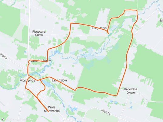
Trasa
| Podział | Dystans (km) | Czas trwania (min) | Różnica wysokości (m) | Średnia prędkość (m/s) |
|---|---|---|---|---|
| 1 | 1.00 | 4:05 | -13.2 | 4.12 |
| 2 | 1.01 | 3:55 | 0.9 | 4.76 |
| 3 | 0.99 | 3:95 | -1.4 | 4.16 |
| 4 | 1.02 | 13:18 | 6.1 | 3.88 |
| 5 | 1.00 | 4:25 | -6.3 | 3.92 |
| 6 | 0.98 | 3:33 | 4.7 | 4.92 |
| 7 | 1.02 | 4:1 | 5.2 | 4.13 |
| 8 | 1.00 | 4:75 | 19.6 | 3.49 |
| 9 | 1.01 | 4:8 | -19.6 | 3.51 |
| 10 | 0.98 | 5:08 | 7 | 4.46 |
| 11 | 1.02 | 5:98 | -3.8 | 3.5 |
| 12 | 1.00 | 11:43 | 6 | 2.83 |
| 13 | 1.00 | 4:95 | -1.5 | 3.37 |
| 14 | 1.00 | 4:07 | -7.6 | 4.11 |
| 15 | 0.98 | 6:5 | 11.2 | 3.74 |
| 16 | 1.02 | 5:12 | 1.7 | 3.31 |
| 17 | 0.99 | 2:97 | -1.8 | 5.56 |
| 18 | 0.99 | 4:18 | -13.9 | 3.95 |
| 19 | 1.03 | 3:12 | -4.6 | 5.52 |
| 20 | 0.97 | 3:23 | 6.5 | 5 |
| 21 | 1.01 | 3:82 | -9 | 4.43 |
| 22 | 0.99 | 25:97 | 3.6 | 2.16 |
| 23 | 1.00 | 4:07 | 9.1 | 4.09 |
| 24 | 0.11 | 1:5 | 1.3 | 1.24 |
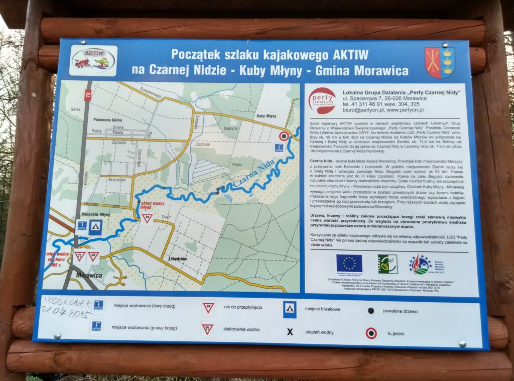
Miejscowości
- województwo świętokrzyskie
- powiat kielecki
- gmina Daleszyce
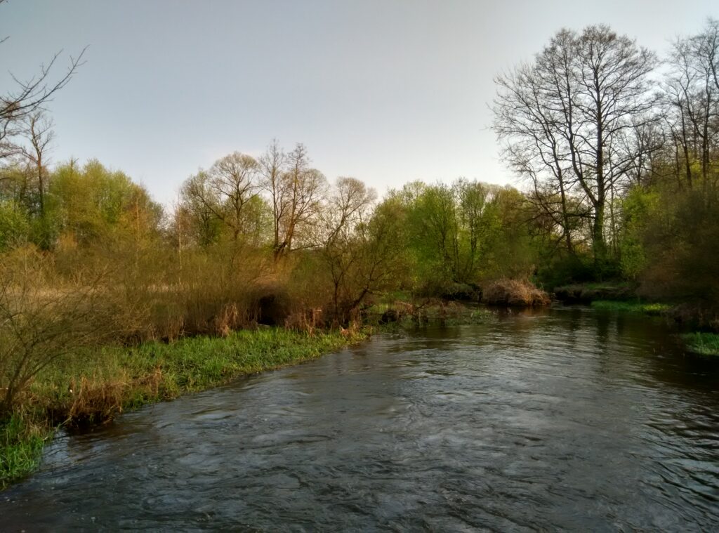
- Suków
- Marzysz
- gmina Morawica
- Radomice
- Brzeziny
- Bieleckie Młyny
- Bilcza
- Dyminy
- Łabędziów
- Kuby-Młyny
- Morawica
- Wola Morawicka
- gmina Daleszyce
- powiat kielecki
Strava segmenty
| Nazwa | Czas trwania (s) | Czas w ruchu (s) | Odległość (m) | Średnie nachylenie (%) | Maksymalne nachylenie (%) | Wysokość maks. | Wysokość min. |
|---|---|---|---|---|---|---|---|
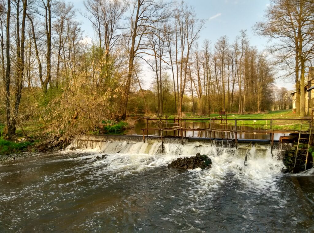
| Kuby-Młyny podjazd | 77 | 77 | 355.7 | 7.4 | 10.7 | 261.8 | 235.6 |
| Młyny (Czarna Nida) do hopki | 153 | 153 | 481.1 | 1.9 | 8.7 | 257.6 | 247.8 |
| Młyny (Czarna Nida) - Marzysz Drugi | 311 | 311 | 1084.9 | 0.6 | 5.7 | 243.8 | 236.1 |
| Marzysz Drugi - Radomice Drugie (przez Wydrzysz) | 745 | 618 | 2430.6 | 0.6 | 8.9 | 257.5 | 238.4 |
| Wydrzysz podjazd | 136 | 136 | 376.7 | 4.6 | 6.5 | 256 | 238.6 |
| Wydrzyszcz - Łabędziów | 471 | 471 | 2327.8 | -0.9 | 2.4 | 255.5 | 235.2 |
| Łabędziów - Morawica | 469 | 469 | 2539.9 | -0.2 | 4.3 | 237.5 | 228.6 |
Punkty GPS na trasie
Wszystkie: 861Uproszczone: 141