05.08.2017 18:52
Ride
-
Dystans
27.28 km
-
Średnia prędkość
20.76 km/h
-
Maksymalna prędkość
47.43 km/h
-
Czas ruchu
01:18
-
Całkowity czas
01:48
-
Najniższa wysokość
228.1 m
-
Najwyższa wysokość
265.6 m
-
Suma przewyższeń
132.1 m
-
Kalorie
674
-
Kwadraty
19
-
Osiągnięcia
6
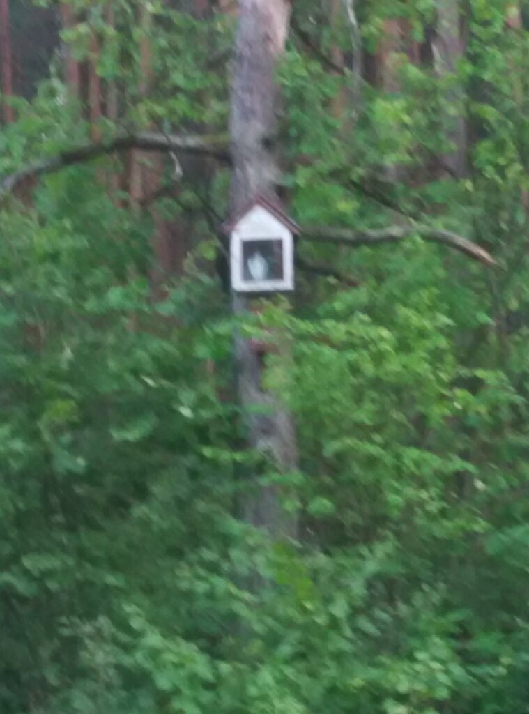
Zdjęcia na trasie
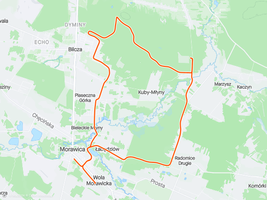
Trasa
| Podział | Dystans (km) | Czas trwania (min) | Różnica wysokości (m) | Średnia prędkość (m/s) |
|---|---|---|---|---|
| 1 | 1.02 | 3:18 | 2 | 5.35 |
| 2 | 0.99 | 2:6 | -1.3 | 6.33 |
| 3 | 1.00 | 2:7 | 0.3 | 6.18 |
| 4 | 1.03 | 2:92 | 4.3 | 5.88 |
| 5 | 0.97 | 3:18 | 13.5 | 5.08 |
| 6 | 1.02 | 2:57 | -2.8 | 6.65 |
| 7 | 0.98 | 2:73 | 9.6 | 5.95 |
| 8 | 1.00 | 2:67 | 1.1 | 6.27 |
| 9 | 1.01 | 3:1 | -0.7 | 5.45 |
| 10 | 1.04 | 2:98 | -1.5 | 5.81 |
| 11 | 0.95 | 3:55 | 6 | 4.46 |
| 12 | 0.99 | 2:55 | -9.8 | 6.48 |
| 13 | 1.00 | 2:98 | 0.7 | 5.6 |
| 14 | 0.99 | 2:2 | -8 | 7.46 |
| 15 | 1.01 | 2:6 | -3.2 | 6.45 |
| 16 | 1.00 | 5:07 | 8.7 | 3.28 |
| 17 | 1.03 | 2:9 | -9.1 | 5.93 |
| 18 | 0.98 | 2:75 | -1.3 | 5.94 |
| 19 | 1.00 | 2:53 | 0.8 | 6.55 |
| 20 | 1.05 | 3:05 | 3.6 | 5.75 |
| 21 | 0.96 | 2:25 | 7.8 | 7.13 |
| 22 | 1.04 | 2:03 | -9.7 | 8.52 |
| 23 | 0.97 | 2:17 | -5.4 | 7.48 |
| 24 | 0.96 | 2:27 | -2.4 | 7.09 |
| 25 | 1.01 | 2:57 | -3.2 | 6.55 |
| 26 | 1.02 | 2:88 | 0.3 | 5.87 |
| 27 | 0.99 | 3:97 | 10.3 | 4.16 |
| 28 | 0.26 | 31:47 | 0.7 | 2.32 |
Miejscowości
- województwo świętokrzyskie
- powiat kielecki
- gmina Daleszyce
- Suków
- Marzysz
- gmina Morawica
- Bilcza
- Dyminy
- Łabędziów
- Morawica
- Wola Morawicka
- Radomice
- Bieleckie Młyny
- Piaseczna Górka
- gmina Daleszyce
- powiat kielecki
Strava segmenty
| Nazwa | Czas trwania (s) | Czas w ruchu (s) | Odległość (m) | Średnie nachylenie (%) | Maksymalne nachylenie (%) | Wysokość maks. | Wysokość min. |
|---|---|---|---|---|---|---|---|
| Młyny (Czarna Nida) - Marzysz Drugi | 197 | 197 | 1084.9 | 0.6 | 5.7 | 243.8 | 236.1 |
| Młyny (Czarna Nida) do hopki | 98 | 98 | 481.1 | 1.9 | 8.7 | 257.6 | 247.8 |
| Marzysz Drugi - Radomice Drugie (przez Wydrzysz) | 382 | 382 | 2430.6 | 0.6 | 8.9 | 257.5 | 238.4 |
| Wydrzysz podjazd | 85 | 85 | 376.7 | 4.6 | 6.5 | 256 | 238.6 |
| Wydrzyszcz - Łabędziów | 293 | 293 | 2327.8 | -0.9 | 2.4 | 255.5 | 235.2 |
Punkty GPS na trasie
Wszystkie: 812Uproszczone: 147